About the Mississippi River

The Mississippi River
The following is a description of the Mississippi River in the section that the Two Paddles’ events use in Minnesota, followed by information about the entire river.
The Mississippi River is about 2,300 miles long. At Itasca State Park in northern Minnesota the headwaters could be designated as mile marker 2300, but on the official US Army Corps of Engineers maps the headwaters are designated mile 1,341.6. This represents the number of miles the river flows until it reaches the confluence with the Ohio River, at which point the mileage resets to 954 and counts down to the Gulf of Mexico. 1,341.6 plus 954 equals 2,295.6 miles per the Corps.
There are about 500 river miles from the headwaters until you reach Minneapolis. The Mississippi River 145 Canoe and Kayak race (the MR 145) takes place from mile marker 1006 at Lum Park in Brainerd and goes to mile 871 at Peninsula Point Park in Anoka (the race starts by going six miles upstream in a flat water section then turning around). When you put your boat in the water at the start of the race the Mississippi has already flowed 335 miles.

There are fourteen dams prior to Minneapolis, all of which must be portaged around; there are no locks. Eight of the dams are upstream from the start of the MR 145. After Brainerd there are five dams that must be portaged around in the first 80 miles of the MR 150 route. The fifth dam is the St. Cloud dam, after that, the final 55 miles of the event are free-flowing and unobstructed. The MR 43, MR 20, MR 12, the 5-mile “Root Beer Float” all start within this fifty-five mile stretch. All of these events end at Peninsula Point Park in Anoka.
Over the course of the 152.5 miles of the river that the Two Paddles events use during the “Minnesota Paddling Opener” there are four major tributaries that join the Mississippi. They are all excellent paddling rivers and, like the Mississippi, are designated as recreational Water Trails by the Minnesota Department of Natural Resources. In order they are: the Crow Wing River which enters from the west at mile 990.6 (26 miles into the MR 145 race), the Sauk River which enters from the west in St. Cloud at mile 929.7 (86 miles into MR 145 race), the Crow River which enters from the west at mile 879.6 (along the course of the MR 145, 43 and 20) and the Rum River which enters from the north (on the “east” side of the river) at mile 871.4—right at the finish line.

The first section of the MR 145 is 58 miles from Brainerd to the city of Little Falls. First, racers paddle about six miles upstream against little to no current before paddling around a buoy and coming back downstream. This spreads out the field ahead of the first portage at the Brainerd Dam. Next,, paddlers pass through the cities of Brainerd and Baxter. The city of Brainerd is famous for having 460 lakes within 25 miles and Minnesotans associate the area with the lakes, cabins and pine trees of northern Minnesota. Paddlers will pass eight miles on the east bank that are part of Crow Wing State Park. Later, after the Crow Wing River joins the Mississippi, the Fort Ripley Military Reservation lies on the west bank for 18 miles. This first 58 miles ends in the city of Little Falls at the portage around the dam.
The second section of the MR 145 race is 39 miles from Little Falls to St. Cloud. It starts with a paddle on Zebulon Pike lake. Nine miles from Little Falls later is the portage around the Blanchard Dam, which at 47 feet is the tallest dam on the river. It is an impressive site when the water is high and a loud, powerful torrent of water comes over it. The portage trail includes a challenging up-and-down single-track trail through the forest. 24 miles later is the portage around the Sartell Dam and the three cities of Sartell, Sauk Rapids and St. Cloud. Together these cities form the largest metropolitan area in central Minnesota. 3 miles later is the exciting class 1-2 Sauk Rapids, and three miles beyond that is the final portage of the MR 145 at the St. Cloud dam. Paddlers must portage around the upper Sauk rapids but have the option to run or portage the lower section.
In the third section of the race, the 60 miles from the St. Cloud dam to the finish, there are over 100 islands and no dams or portages. This section begins with the 12 mile state designated scenic and wild section through the Beaver Islands. At the conclusion of those 12 miles is the town of Clearwater, which is where the MR 43 starts (from the Clearwater boat ramp on the east side of the river). The river flows 16 more miles to the town of Monticello then seven more miles to Norin Landing/Kadler Ave. ramp in Otsego which serves as the starting point for the MR 20 race. From there the river flows past historic downtown Elk River and Babcock Park at mile 883.4, the start of the MR 12.
At mile 879 paddlers will enter the Mississippi National River and Recreation area. This national park service administered corridor runs for the next 72 miles. The first 16 miles of the recreation area are classified as ‘wild and scenic’. The next landmark is the Mississippi West Regional Park ramp in Ramsey, the starting point for the “5-mile Root Beer Float”. 5 miles downstream is the finish line for all events in Anoka.

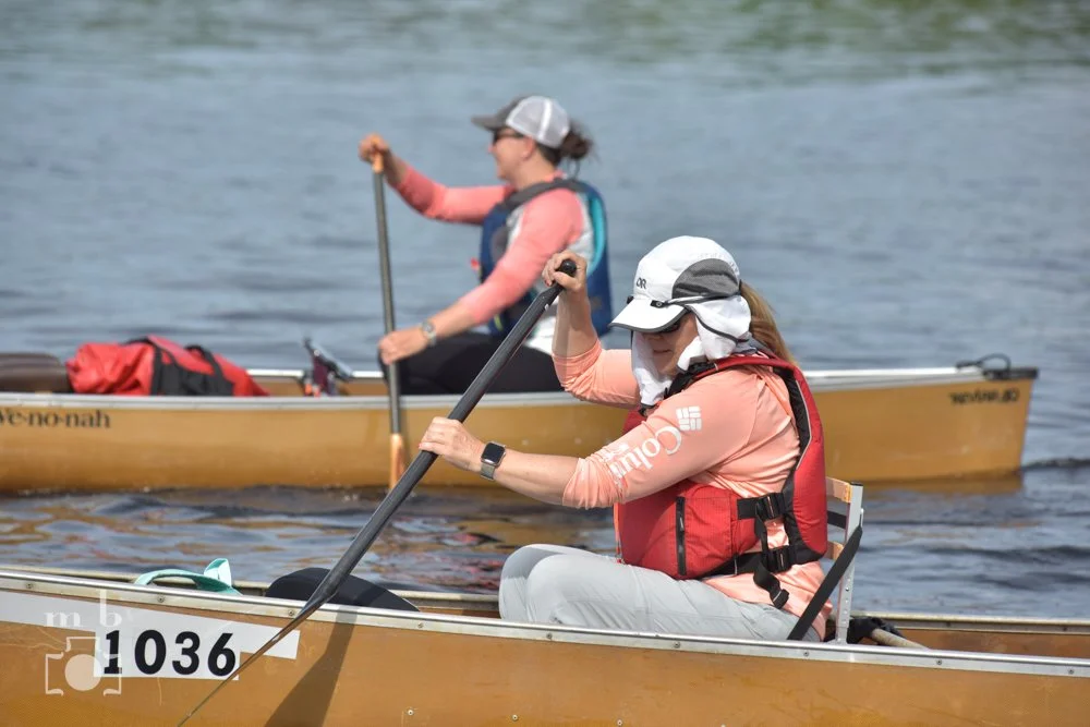
Scott and Todd taking a break on the Mississippi River
Beyond the finish line the river flow 5 miles to the Coon Rapids Dam, then 11 more miles to downtown Minneapolis, St. Anthony Falls and the Upper St. Anthony Lock and Dam. St. Anthony Falls is the only major waterfall on the river; it now consists mostly of a reinforced concrete downslope. The Upper St. Anthony lock was permanently closed in 2015; paddlers wishing to continue downstream must portage around. After that, assuming all the locks are open, a person could continue all the way to the Gulf of Mexico without getting out of their boat.
Info about the entire Mississippi River
The Mississippi River is the second longest river in the United States. How long is it? That depends on who you ask. Most estimates are between 2,300 and 2,350 miles, but some sources have it as long as 2,552 miles. It starts at Lake Itasca in northern Minnesota and makes a question mark shape as it flows 681 miles through Minnesota—the most miles of any state the river flows through. Minnesota is one of only two states the river flows mostly “through”, the other being the last state it flows through, Louisiana. For every other state the river touches (there are eight others, for a total of ten), the river serves as a border. In order, the ten states are: Minnesota, Wisconsin, Iowa, Illinois, Missouri, Arkansas, Kentucky, Tennessee, Mississippi and Louisiana. With all of it’s tributaries, the Mississippi's watershed drains all or parts of 32 U.S. states and two Canadian provinces. It is the fourth-longest river in the world and certainly the most famous river in the United States.
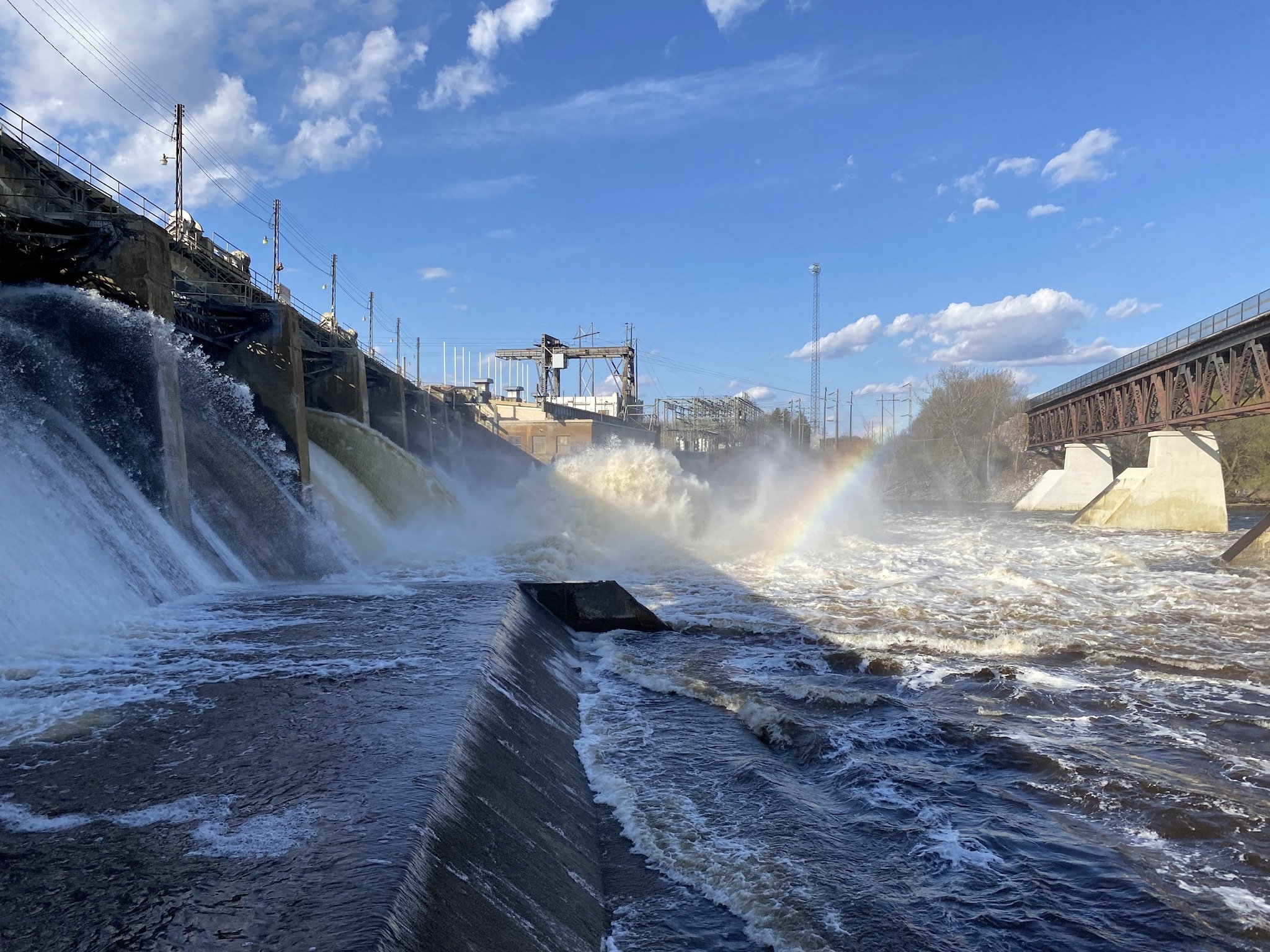
Blanchard Dam
To move goods up and down the Mississippi, the U.S. Army Corps of Engineers maintains a 9-foot deep shipping channel from Baton Rouge, LA to Minneapolis, MN. From Baton Rouge past New Orleans to Head of Passes, a 45 foot channel is maintained to allow ocean-going vessels access to ports between New Orleans and Baton Rouge.
The river can be divided into three sections. The first section, from Lake Itasca to Minneapolis/St. Paul, has 14 dams that must be portaged around. The second “middle” section of the Mississippi, from St. Paul to St. Louis, has 29 locks and dams. At every lock there is a chance the canoeists will have to wait, up to many hours, for the lock to be ready for them to go through. Finally the “lower” Mississippi, 1,000 miles of free-flowing, fairly “wilderness-y” river but for barges, flows all the way to the Gulf of Mexico.
(Some of this information was found at the informative Mississippi River National River and Recreation Area’s website at: Mississippi River Facts)